
Survey & Alignment Services
12 Years
in Business

Deliver precision, innovation, and tailored surveying solutions that drive successful projects across Tasmania and Australia.
Since 2014, Survey & Alignment Services has provided essential support and leading industry expertise to a range of national and international engineering projects.
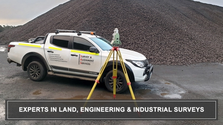
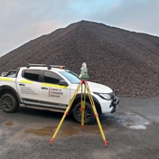
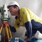
At Survey & Alignment Services, we are experts in land, engineering, and industrial surveys, providing the precision and expertise needed to make your project a success. Based in Launceston, Tasmania, our qualified land surveyors and CASA-certified UAV pilots offer a comprehensive suite of services tailored to meet your unique requirements in Riverside and beyond. With a commitment to delivering top-tier results, we provide industrial alignment, engineering surveying, land development, and aerial mapping and inspection services across Tasmania and Australia.
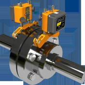
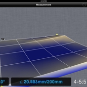
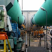
Our industrial alignment services ensure machinery operates flawlessly with laser shaft and coupling alignment, overall machine alignment, and geometrical tolerance auditing. For engineering needs, we specialise in aerial drone mapping, topographical and monitoring surveys, and other precise measurements vital to construction and infrastructure projects. In land development, we assist with subdivision planning, strata titles, remarks surveys, and proposal plans, offering expert guidance from conception to completion, including planning services to streamline the approval process.
With the latest drone technology, our aerial mapping and inspection services deliver exceptional detail in topographic mapping, volume calculations, and engineering inspections. These services are also invaluable for real estate photography, providing dynamic visuals to showcase properties. At Survey & Alignment Services in Riverside, client relationships and satisfaction are at the core of what we do. We work collaboratively to understand your needs and are dedicated to achieving the best outcomes efficiently and effectively. Call us for further information!
What is industrial alignment?
Industrial alignment ensures machinery operates efficiently by using laser technology for precise alignment of shafts, couplings, and overall machine geometrical tolerance auditing.
What can aerial mapping and drone services do for my project?
Our CASA-certified UAV pilots provide topographic mapping, volume calculations, engineering inspections, and real estate photography with high detail and accuracy.
What areas do you service?
We are based in Launceston, Tasmania, and provide surveying services throughout Tasmania and Australia for land, engineering, and industrial projects.
How do you tailor surveys to client needs?
We assess your project’s specific requirements and customise our approach using advanced tools and expertise to ensure accurate, efficient results.
Do you assist with land development planning?
Yes, we provide subdivision, strata titles, proposal plans, remark surveys, and planning services to guide your development project from start to finish.