

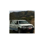
Zenith Surveying Services
14 Years with
Yellow Pages

We strive to offer professional and cost-effective survey services, ensuring timeliness and accuracy for all clients.
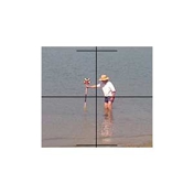
Zenith Surveying Services is a small multidisciplinary surveying practice managed by a registered surveyor with over 30 years experience. Zenith covers the whole spectrum of all cadastral and engineering type surveys and can assist you with all residential and commercial survey requirements using the latest techniques, equipment and CAD programs. We strive to provide a professional and cost effective service in a time efficient manner. We are small enough to be personal, but large enough to cater for all of your surveying needs.
At Zenith Surveying Services, we are a professional and dedicated team based in Tuncurry, offering thorough surveying solutions that span the spectrum of cadastral and engineering requirements. As a small multidisciplinary surveying practice, we are uniquely positioned to offer personalized services while simultaneously having the capacity to handle expansive projects. Our project scale and scope can flexibly adjust to cater to individual property owners as well as larger clients such as government bodies, architects, builders, developers, engineers, solicitors, and real estate agents.
One of our foundational principles is providing services that are both time-efficient and cost-effective. Understanding the importance of project timescales, we strive to guarantee that all surveying requirements are met within agreed deadlines without compromising on quality or accuracy. Additionally, we aim to deliver services that are as cost-efficient as possible, understanding that budget is often as critical as the build for our clients.
Our commitment to our clients doesn't end at delivering excellent services. We believe in building long-standing relationships with all stakeholders involved in the projects. Therefore, comprehensive support, advice, and consultation are integral parts of our service offering. Whether it's navigating new planning policies, understanding land subdivision processes, or delineating boundary marks, our expert team is ready to assist, ensuring clarity and peace of mind throughout every stage of a project.
What is a detail survey?
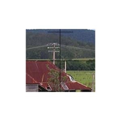
A details Survey is a mud map, or a representation of all improvements contained on the parcel of land and may at request contain levels and show contours on the survey plan. Contours being a line of equal heights and relate to a specify height datum.
How can surveying services assist real estate agents?
Accurate land surveys can provide vital information for property listings and legal transactions.
What to know before subdividing land?
Before land subdivision can occur the client/landowner needs to ensure that the land is zoned to be further fragmented /subdivided. The interested party can either consult the local Council website or use a local Town planner to find out. Should further subdivision be permissible the next step is to lodge a Development Application (DA) to be lodged with Council. This will require a site plan, or a Contour a Detail prepared by a surveyor to accompany the DA.
What is the difference between boundary marks and survey marks?
Boundary marks are marks that are specifically used to identify the perimeter boundaries of a parcel of land that forms part of the cadastre. A Surveyor is bound under the Surveying Practice Regulation Act to use a set of approved type of survey marks. Other survey marks used in construction Setout of buildings or roads consist of a multitude of other markings including pegs, star pickets, reo-bars, nails in profiles and wooden stakes.
Is there a need for surveying services in property development?
Essential for exact land measurements, planning permission and meeting regulatory guidelines.
Who can benefit from surveying services?
Government bodies, architects, builders, developers, real estate agents, and individual property owners.
What is the minimum land size for subdivision in Midcoast Council area?
Typically, the land size for a Torrens title subdivision is 450msq. However new planning policies allow land to be subdivided to be as low as 200msq in certain circumstances if the planning objectives can be met. We recommend consulting a local town planner to provide guidance in this subdivision process.
What equipment do you use?
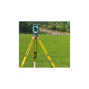
We utilise Leica electronic Total Stations, Civil CAD & Landmark software, and AutoCAD drafting.
Can we get electronic plans delivered?
Yes, we deliver electronic plans using modern CAD software.
Do you serve areas outside of Tuncurry?
Yes, we extend our services from Port Macquarie to Karuah and Gloucester.